

Weather forecasting is not as easy as it sounds — both at sea and on land, because the atmosphere is diverse and chaotic. It’s hard to calculate.
Take for instance the fact that weather models — computer programs used to make weather forecasts, do not take local winds into account all the way through. It is because of the peculiarities of the local topography, on which many weather conditions depend — not just winds.
Now there is active work in this direction and modern high-resolution models, such as AROME, can already show local phenomena. Still, it remains a very challenging place for models. So you have to rely on your own knowledge and experience also.
Let’s learn how these three common local winds form and how do they work, namely breeze, mistral, and bora.

Breeze

The most common example of local wind is a breeze.
In general, a breeze is a light wind, which appears due to the temperature difference between two air masses. Breezes occur when there are a land and water boundary (e.g., the sea).
This is how it forms exactly:
- The air, which warms up above the land, becomes light and rushes up, and cooler air from the sea immediately replaces it.
- This process lasts all day, as long as there is a stream of heated air over the coast. Such a breeze is called “Daytime breeze” and can be very calm: 1–5 meters per second.
- Depending on the heating force, the land affects the circulation of the air flow. The more heating up the land, the greater the temperature difference, the stronger the breeze is.
- At night, the temperature above the land may become cooler than above the water. Then the air flows change their direction and blow from the land towards the sea. This forms the night breeze.
Breezes appear in cities and forests, too.
Their appearance is possible due to the heating of buildings by sunlight, which creates a difference in air temperature outside the city and in it. The difference can reach 8 degrees. This is enough for the cooled air to move from the suburban areas towards the city. Depending on the layout of the streets, this process can cause an increase in the wind. Most often, the air flows through wider streets.
In large forests, the temperature during the day is lower than in the fields next to them. This is because most of the solar energy is spent on the evaporation of moisture from the leaves. Because of this, during the day, a gentle wind moves from the cold forest towards the field.
In contrast to sea or forest breezes, the city breeze moves around the clock.
Mistral

The local winds can also be very strong, with suitable conditions only in a particular part of the coast.
For example, the mistral. It can be very destructive and only occurs on the Mediterranean coast of France.
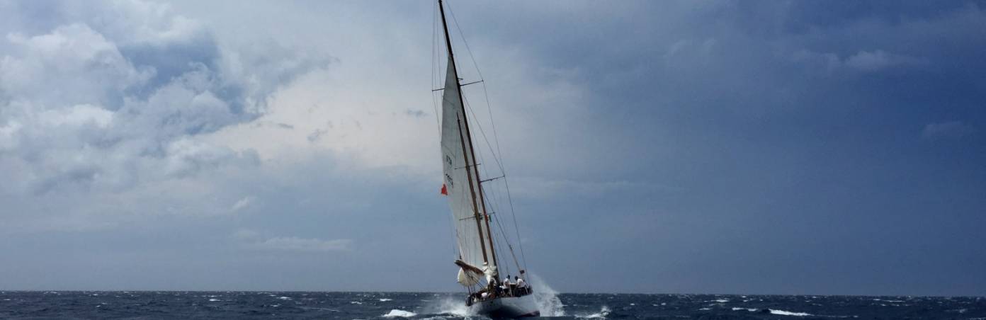
It is a cold and very strong wind. Its speed often exceeds 66 km/h (41 miles per hour). The mistral is responsible for an unimaginable number of broken masts and yachtsmen’s failed plans... Besides, in spring and summer, the mistral comes to the region very dry and causes significant damage to agriculture.
Sometimes it lasts only one or two days, often several days in a row, but it can last even more than a week. In Marseille, in southern France, the mistral is observed most often — 175 days a year! It is the local characteristics of the region that make the wind strong and destructive. How does the mistral appear?
Because it is a local wind, it is determined by the terrain. The general scheme of this wind’s appearance:
- The synoptic situation is such that there is a current heading to the south to France, towards the foothills of the Alps.
- Reaching them, the stream is fed by the cold mountain air. The heavy cold air rolls down from the mountains towards the sea. Rolling down, the wind speeds up.
- Then the air passes through narrow places in the terrain — mountain passes and river valleys — and there it accelerates even more.
- Finally, the wind accelerates further above the Gulf of Lion.
At the first stage, the synoptic situation is responsible for the appearance of the mistral. For the mistral, the situation is favorable when an anticyclone appears over the Bay of Biscay, in the west of France, and a cyclone appears over the Gulf of Genoa, in southern Italy.
In the case of the mistral over the Bay of Biscay, the air descends, and at the surface, it follows the path of rotation towards the Mediterranean Sea across France. And this flow becomes the starting point of the mistral.
Bora

Winds such as the mistral occur in other places too, but there they are called differently — for example, bora.
The bora is also a strong cold wind. Such winds are observed in several places on our planet: on the northern coast of the Adriatic Sea, on the western coast of Novaya Zemlya, on the Crimean coast of the Black Sea, on the shores of large lakes.
Wind speed during the bora can exceed 60 m/s, and some gusts reach 100 m/s. Such winds are categorized as storms or hurricanes on the Beaufort scale — they cause a lot of destruction, as well as fatalities.
The name of the wind comes from the ancient Greek word ’boreas’, which means ’northern’. To the ancient Greeks, Boreas was the god of the stormy northern wind. They believed he lived in the north of Ancient Greece. It is from the north (or northeast) that the bora comes most often.
How does the bora form? There are unique natural conditions favoring the formation of this wind in places where the bora occurs. It is a low mountain range stretching along the coast of a sea or a large lake.
We will look into the mechanics of the bora using the Novorossiysk bora, which is observed on the coast of the Black Sea, in Russia, as an example. The bora forms here due to the presence of the low Markotkh Range (its maximum height is only 717 m). The mechanism of the bora can be briefly described as follows:
- A synoptic situation suitable for the bora occurs.
- A wind current appears which moves from land to the water body.
- The current collides with the mountain range.
- The current flows around the range and bears down toward the sea. During the Novorossiysk bora, it bears down directly on the city of Novorossiysk.
The peculiarity of the bora (if compared to the mistral, for example) is that the wind can cause a very significant fall in temperature. The air coming to the Black Sea (in the case of the Novorossiysk bora) can differ by more than 20 degrees Celsius. As a result, the temperature in Novorossiysk can drop to 35 degrees below zero with the arrival of the winter bora and the daily temperature drop can reach 40 degrees.
Bora can literally freeze anything that comes on its way. For example, ice is freezing up the embankments in huge layers, as if an Ice Age had return.
To make it happen, atmospheric pressure has to be distributed over a vast territory around the mountain range in a certain way.
The destructive wind usually lasts in Novorossiysk from a couple of days to a week, and the longest episode of the bora lasted a month and a half. Every year Novorossiysk experiences about 50 bora days, most of them — in March and November.
In different regions, there are different names for the bora. The bora dispersing waves in Novorossiysk and Gelendzhik bays on the Black Sea is often called the ’nord-ost’, in Croatia, it’s ’scura’ or ’bura’. Similar winds can be observed on the shores of large lakes, such as Lake Baikal — here it’s the ’sarma’.
Learn more about these and other winds, and other weather phenomena, in “The Basic Meteorology for Wind Sports and Outdoors” — Windy.app textbook with 50+ lessons on better weather forecasting.


